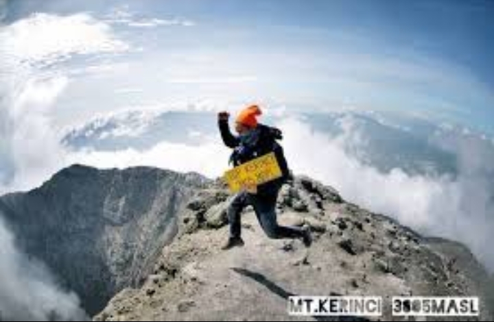
Mt Kerinci is the highest mountain on the island of Sumatra and it is popular with mountain climbers. The nearest village and climber’s base is Kersik Tuo, near Kayu Aro, Kerinci. The route is marked by signs, posted at half kilometer intervals. Mt Kerinci is also known by the name Indrapura Peak, Mountain Tower, Volcano Kurinci and Korinci. This is one of mountain climbers’ favourite since the trail condition of the mountain is clear and easy to follow.
Get There
Fly to Padang the capital of West Sumatra Province and then go to the town of Sungai Penuh, District of Kerinci in Jambi Province which is 7-8 hours drive from Padang or 278 km. Otherwise, you can go to the village of Kersik Tuo with a distance of 211 km from Padang or approximately 5-6 hours drive.
Towering over the Sumatran landscape, Mt.Kerinci demands respect. At 3805 meters tall, Gunung Kerinci is the highest active volcano in Southeast Asia, and even rises above the iconic Mt. Fuji in Japan, and Lombok’s Mt. Rinjani. Trekking up its forested slopes, protected within the Kerinci Seblat National Park, is quite challenging as there are no switchbacks – it’s just straight up to the top along a ridge trail. But the views at the top are truly unbeatable, making the struggle and sweat to the summit more than worth it.
Leave your lodging in the morning to begin your Mt. Kerinci climb. On the way to the trail head, don’t forget to turn around and see the incredible view of the beautiful Kayu Aro tea plantation, rice fields, the Rawa Bento wetlands, and Mt. Tujuh off in the distance.
Once in the forest, be on the lookout for Yellow-handed Mitered Langurs (our endemic, orange leaf monkeys), lizards, and birds. You’ll hear the enchanting song of Siamang gibbons, and if you’re really lucky, you might even spot a family of them. Make camp after about 8 hours of hiking, and prepare yourself for a chilly night and early morning.
Before dawn, scramble an additional two hours up the scree and rubble until you reach the crater. Bask in the view above the clouds as the sun rises, flooding the valley below with light. If you’re lucky, you’ll be able to see lava bubbling far below in the bottom of the crater, and on a clear day you can see all the way to the Indian ocean to your west.
Congratulations, you’re now the tallest person on Sumatra!
Eventually, make your way back down the mountain, emerging from the jungle after about six hours, in the mid- to late afternoon. After a climb up Mt. Kerinci, expect a few days of sore legs to follow 🙂
To savor the hike (and make it a little easier), spend an extra night on the slopes of the volcano either going up or coming down.
Slow and steady wins the race (and usually results in more wildlife spotting).
Sumber:
wildsumatera.com
Indonesia.travel


